
Most people first see GEODI as a text search tool.
In reality, it is an analytical engine that uncovers the hidden meaning inside data.
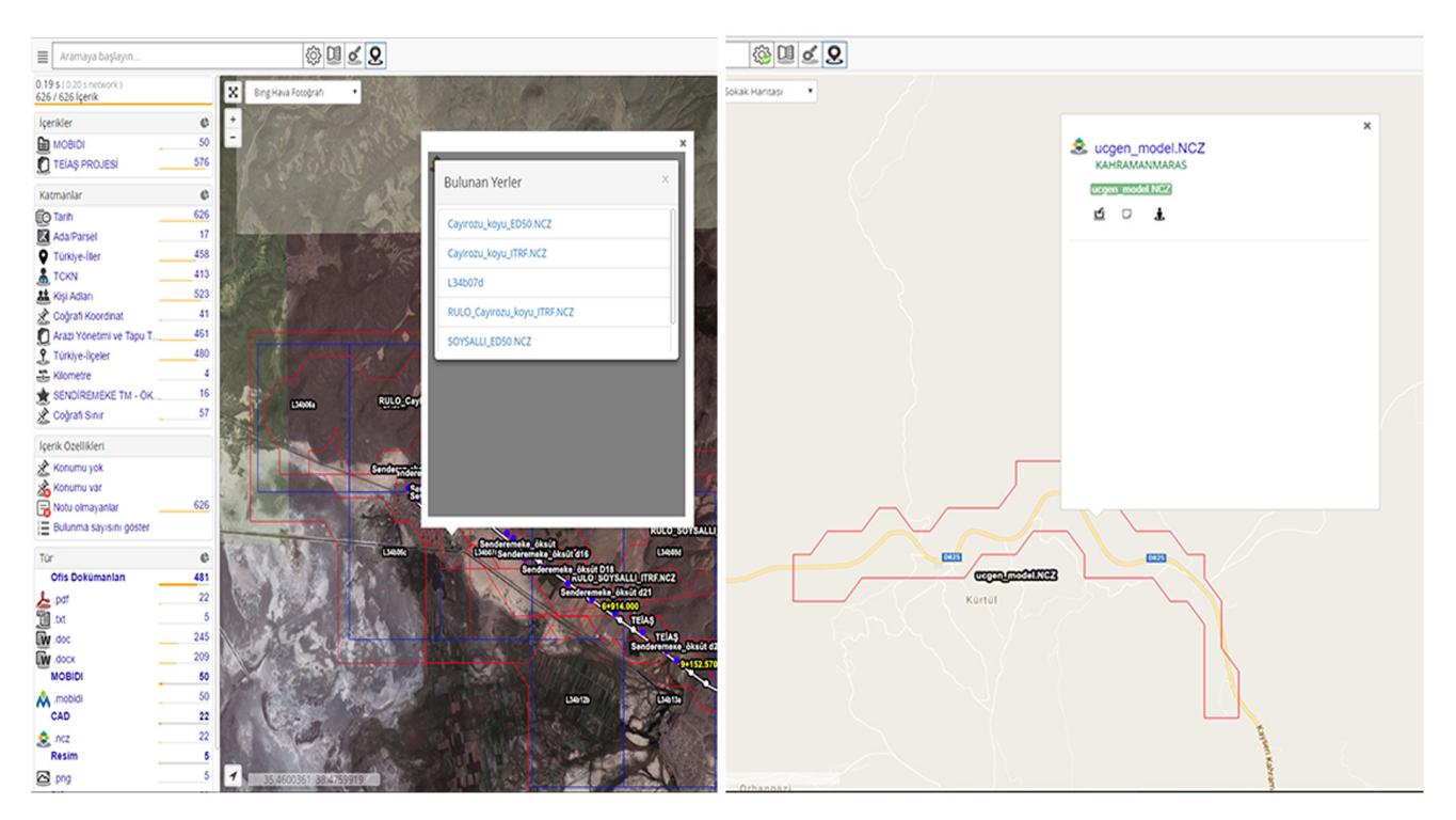
It doesn’t just find words — it understands context.
All without predefined rules.
With the Geo Archive module, this intelligence moves into the geographical domain.
Simply show GEODI where your files are stored.
It will:
No conversion.
No duplication.
No manual preparation.
Even if there are thousands of files.
Click a boundary → open the original document → navigate through adjacent drawings.
Supports 200+ formats including DWG, DGN, SHP, ECW, TIF, DTED, and KML.
And these are real geometries — not rectangular approximations.
Traditional GIS workflows require:
GEODI completes the same process automatically in days.
Geo Archive is not limited to CAD and GIS.
It also understands location data hidden inside:
It detects coordinates, identifies projection types with AI, and positions everything correctly on the map.
So your search results don’t come as a list —
they appear as contextual, map-based insight.
More about GIS: Map of News

